
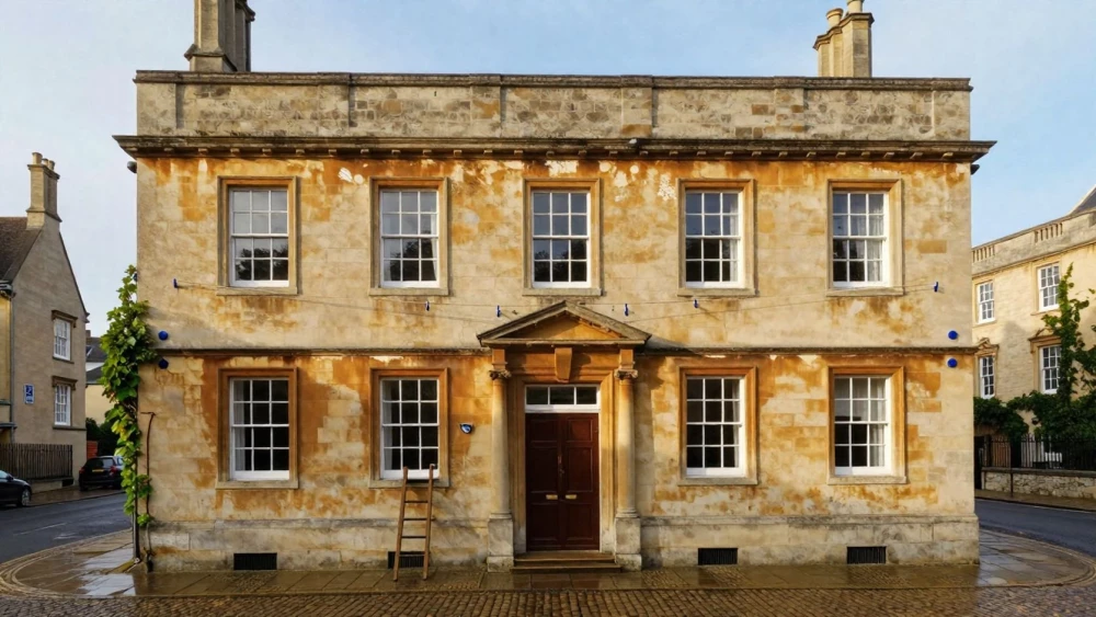
Building Elevations
Get in TouchAt Oxford Surveys, we specialise in providing detailed building elevation surveys . Building elevations are critical for architects, planners, and builders to accurately represent the façade of structures.
Our team uses advanced surveying technology to capture precise measurements and dimensions, ensuring the highest standard of detail and accuracy. Whether it’s for renovation projects or new builds, we cater to a wide range of properties including residential, commercial, and industrial buildings.
Contact us today to arrange a detailed survey and get your project started right.
Book Building Elevations Today
How Much Does a Building Elevation Survey Cost?
A building elevation survey typically costs between £300 and £1,000. The exact price depends on factors such as the size and complexity of the building and the scope of the survey required.
Survey type also influences cost; for example, detailed surveys using laser scanning technology to capture intricate architectural details might add to the expense. We adhere to RICS standards to ensure accurate and reliable measurements, including floor levels, rooflines, and façade details.
Other considerations might include access difficulties or the need for specialised equipment like drones for tall structures. More extensive surveys that include multiple façades or additional features may increase the cost.
We recommend contacting us for a personalised quote based on your specific needs.
What Types of Building Elevation Surveys Are Available?
At Oxford Surveys, we offer various types of building elevation surveys to meet diverse project requirements:
2D Elevation Drawings: Providing comprehensive plans and succinct imagery of building exteriors, these surveys are ideal for planning applications and design consultations. They typically include detailed measurements such as wall heights and window positions, ensuring precise compliance with planning regulations.
3D Elevation Models: Interactive models for in-depth visualisation and planning, essential for large-scale developments. Using software like AutoCAD or Revit, these models assist in virtual walkthroughs and aesthetic evaluations before construction.
Topographic Surveys: For projects requiring extensive site details alongside elevation data, our topographic surveys use GPS and total stations to capture terrain contours, surface features, and drainage patterns, informing landscaping and building foundation designs.
As-Built Surveys: Verifying construction accuracy against design plans, these surveys ensure that every aspect of the building meets specified architectural and structural standards. They are crucial for contractors needing to document completed works for client approval.
Each type serves different purposes and can be tailored to fit your project needs, ensuring precise and reliable data for architects, planners, and developers. Contact us today to discuss how we can support your project.
How Does a Building Elevation Survey Work?
The process of conducting a building elevation survey involves several key steps to ensure accurate representation and compliance with standards such as ISO 9001. Our experienced surveyors employ precision tools and techniques throughout the surveying phases.
Initial Consultation: We gather information about client requirements, building specifications, and project deliverables to tailor our approach accordingly.
Site Visit: Our team visits the location to perform preliminary assessments and take precise measurements using total stations and GPS technology.
Data Collection: We use 3D laser scanning and photogrammetry to capture detailed spatial data, ensuring high-resolution images and measurements.
Drafting Reports: Using CAD software, we generate comprehensive elevation drawings or digital models that include elevations, sections, and façade details.
Final Review: We deliver thorough reports to clients, allowing for feedback or modification requests to meet their specific needs.
Our streamlined process ensures both accuracy and efficiency, providing clients with reliable documentation for planning, renovation, or compliance purposes. Contact us to discuss your building elevation survey needs.
How Long Does a Building Elevation Survey Take?
Most building elevation surveys can be completed in one to two days. The duration largely depends on the building's size, the number of features measured, and the complexity of the survey required.
This process involves the use of equipment such as total stations, 3D laser scanners, and GPS units to accurately capture data points and elevations. For larger or more intricate structures like historical buildings, it may take longer due to detailed architectural features that need precise documentation.
Additional time may be necessary for processing data and generating detailed reports, which include floor plans, cross-sections, and façade elevations. Typically, clients receive final drawings within a week after the site survey.
We ensure that all deliverables adhere to RICS standards for accuracy and quality. If you have specific timeframes or requirements, please contact us to discuss your project in detail.
Why Choose Oxford Surveys for Building Elevations?
Choosing Oxford Surveys ensures that your building elevation survey is conducted with the utmost expertise and precision. Our experienced surveyors use advanced laser scanning technology, including 3D laser scanners and Total Stations, to deliver accurate and reliable data.
We also use photogrammetric methods for detailed data capture in both residential and commercial properties. Our survey solutions conform to the RICS standards, ensuring accuracy and compliance across all our projects.
We pride ourselves on our attention to detail and responsiveness to client needs, offering tailored solutions for each unique project. In addition to delivering digital elevation models, we provide comprehensive reports with clear visuals and annotated drawings to aid in planning and design.
Get in touch to see how we can assist with your surveying needs.
Speak to a Building Elevations Expert
Frequently Asked Questions
What is included in the price of a Building Elevation Survey?
Our price typically includes site visits, data collection, processing, and delivery of completed elevation plans or models. Any additional services or specific requirements will be discussed and quoted separately.
How do I maintain the data from a Building Elevation Survey?
Store your survey data securely in digital formats such as PDFs or CAD files. These formats facilitate easy reference for future projects or renovations.
How accurate are the building elevation surveys?
Our surveys are accurate, often within millimetres. We use laser scanning technologies to ensure precision in our results.
Which types of buildings can be surveyed?
We can survey various buildings, including residential homes, commercial premises, and industrial facilities. Each survey is customised to suit the property's specific characteristics and needs.
Which areas do you cover for Building Elevation Surveys?
We provide building elevation surveys primarily . Please contact us for enquiries about surveys outside these areas.
Get a Free Quote for Building Elevations
Contact Oxford Surveys today to discuss your project needs and request a free, no-obligation quote for a building elevation survey.